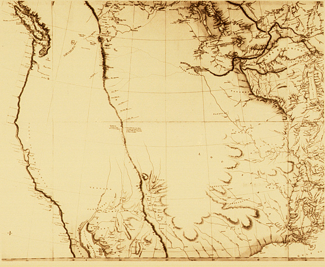
The Arrowsmith map
The famed English cartographer
Arrowsmith prints his map of North America in a successful effort
to keep up with the explosion of geographic knowledge pouring in
from French, English, and Spanish traders in the West. The
new map shows the Sioux ranging from the upper Mississippi to the
Red River and just beyond, to the upper Missouri. Much of
Arrowsmith's information was taken from two remarkable
contributors…Peter Fidler and David Thompson, the best
cartographers in early America. Both had seen the country
with their own eyes and lived with the tribes for extended
periods.
(click here for more)
In 1800, Peter
Fidler build Chesterfield House on the South Saskatchewan River,
and the next year obtained a remarkable map of the Upper Missouri
Basin from a Blackfoot Chief living at the base of the Rocky
Mountains…he took this information to England, where it ended up on
the map drawn by Arrowsmith, and is today preserved in the Kohl
Collection at the Library of Congress. Wheat: "It is
unquestionably the best and most important Indian map that has come
down to our day, and in many respects it is an astonishing
document."
The map shows
the head-streams of the Missouri, like the ribs of a gigantic fan,
flowing eastward from the Rocky Mountains…
Related People
Related Events